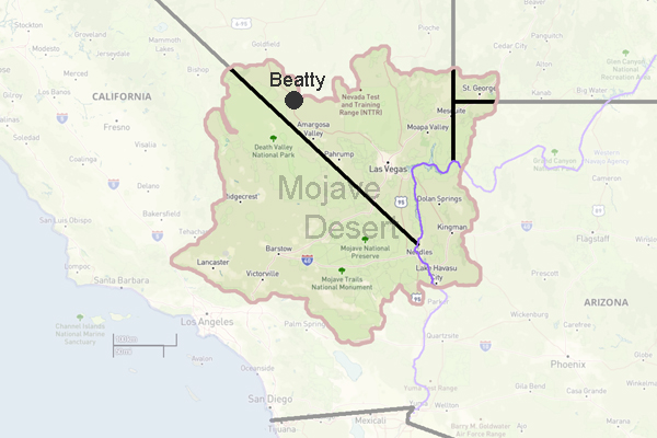
Beatty, Nevada
click for photo gallery
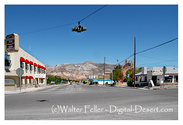
Population, 1,154. Elevation 3,304. A few miles southeast of nowhere, so its easy to find. Nowdays, a gateway to Death Valley, Beatty started out as a supply station for the Bullfrog Mining District.
Beatty, Nevada, is a small town located in Nye County in the U.S. state of Nevada. It is situated in the Amargosa Valley, near Death Valley National Park. With a population of around 1,000, Beatty is known for its tranquil atmosphere and scenic beauty.
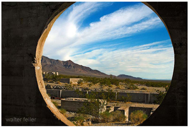
The town of Beatty offers a variety of attractions and activities for visitors to enjoy. One popular destination is the Rhyolite Ghost Town, located just outside Beatty. This former mining town was once a booming community in the early 1900s but is now an interesting historical site. Visitors can explore the old buildings and remnants of the town's past, giving them a glimpse into the area's mining history.
For outdoor enthusiasts, there are plenty of hiking, camping, and wildlife viewing opportunities in Beatty and its surrounding areas. The nearby Death Valley National Park offers breathtaking landscapes, including sand dunes, canyons, and salt flats. Visitors can also enjoy activities such as biking, off-roading, and stargazing.
In addition to its natural beauty, Beatty has a few local attractions worth mentioning. The Beatty Museum and Historical Society provides insights into the town's history and showcases artifacts from the area's mining days. The town also hosts various events throughout the year, such as the Beatty Days Festival, which celebrates the town's heritage and features live music, food vendors, and a parade.
Regarding dining options, Beatty offers a few restaurants and cafes where visitors can grab a bite. Whether you're in the mood for American cuisine, Mexican dishes, or a quick coffee, you'll find something to satisfy your cravings in this charming town.
Accommodations in Beatty range from cozy motels to RV parks, providing options for both overnight stays and longer visits. The town's friendly atmosphere and convenient location make it a great base for exploring the surrounding area and experiencing the unique desert landscape.
In conclusion, Beatty, Nevada, is a small town with a rich history and natural beauty. Whether you're interested in history, outdoor activities, or simply enjoying the tranquility of a small desert town, Beatty has something to offer. So, if you're looking for a peaceful getaway or an adventure in the desert, consider visiting Beatty, Nevada.
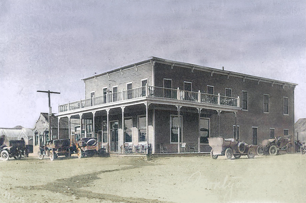
The Montgomery Hotel in 1905. It was owned by Bob Montgomery, namesake of the Montgomery-Shoshone Mine in nearby Rhyolite.
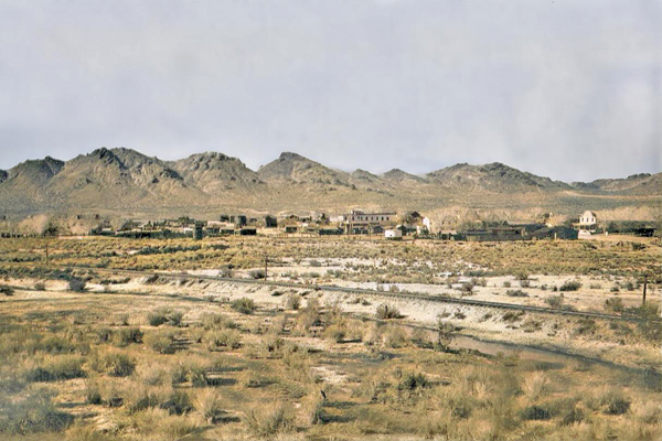
Rhyolite Ghost Town
At that time there was only one other person in the whole area: Old Man Beatty who lived in a ranch with his family five miles away. ...
Railroad History in the Mojave Preserve
The line never did reach the coast or Tonopah, stopping just short of Beatty, Nevada, but served as the "neighborhood railroad" for much of the desert, ...
Skidoo - Death Valley National Park
Plans had already been made for an auto line from Beatty, a stage line seemed definite, application had been made for a post office and with its high ...
Amargosa River
The Amargosa River originates in the mountains surrounding Beatty, Nevada, flows through the Amargosa Desert region, and terminates at Badwater in Death ...
Vanderbilt Mine
Eventually, he interested M. M. Beatty, who had an Indian wife, a member of the same �family group� as Bob Black, and after whom Beatty, Nevada is named. ...
Western Shoshoni Myths
Beatty, Nev.; Tom Stewart, Shoshoni, age about 70. Ash Meadows, Nev., where Shoshoni and Southern Paiute were somewhat mixed, but myths claimed to be ...
Greenwater
On September 7, 1907, the Beatty Bullfrog Miner reported that the Green water Miner had stopped publication and that a hundred people were still at ...
Jimville: A Bret Harte Town - Land of Little Rain - Mary Austin
Says Three Finger, relating the history of the Mariposa, "I took it off'n Tom Beatty, cheap, after his brother Bill was shot." ...
Leadfield Ghost Town
The road winds up through the mountain passes for over fifteen miles from Leadfield to the Beatty highway, and climbs from an elevation of 3400 feet at the ...
Western Shoshoni Myths
Desert & Mountain Fine Art Photo Prints, Shoshone Indians � Western Shoshoni Myths: Beatty, Nevada. The Origin of People. Every day Coyote met a girl. ...
Beatty Weather
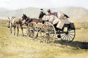
History of Beatty
Beatty Historic Photos
Amargosa River
Rhyolite
Elizalde
Beatty Weather
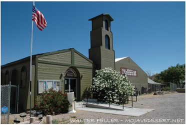
Beatty Museum
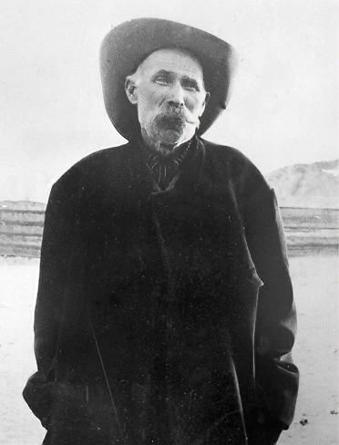
Montillus "Monty" Beatty
The Outfit
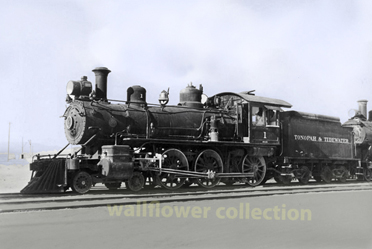
Tonopah & Tidewater Railroad