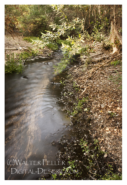
Digital-Desert : Mojave Desert Visit us on Facebook -- Desert Gazette -- Desert Link
Intro:: Nature:: Map:: Points of Interest:: Roads & Trails:: People & History:: Ghosts & Gold:: Communities:: BLOG:: Weather:: :?:: glossary

Rivers & Creeks - Cajon Pass

Cajon Creek

About midway through the Cajon Pass, at the bottom of the canyon there is a perennial creek that flows out of a treed marsh area. This is Cajon Creek. It winds down and around for a mile or two, then splashes around in the rocks and boulders and percolates into the stony alluvium.

This was the first water after descending the steep divide at the edge of the Mojave. The flow was steady and of a good amount to amply meet the needs of traders, pioneers and passing livestock drives.
Photo of Cajon Creek in Cajon Pass on the Old Spanish Trail and John Brown's toll road.
Intro:: Nature:: Map:: Points of Interest:: Roads & Trails:: People & History:: Ghosts & Gold:: Communities:: BLOG:: Weather:: :?:: glossary
Country Life Realty
Wrightwood, Ca.
Mountain Hardware
Wrightwood, Ca.
Canyon Cartography
DesertLink
Links to Desert Museums

Grizzly Cafe
Family Dining


Custom Search

AbeBooks
Abraxas Engineering
privacy
These items are historical in scope and are intended for educational purposes only; they are not meant as an aid for travel planning.
Copyright ©Walter Feller. 1995-2023 - All rights reserved.
102207-11008