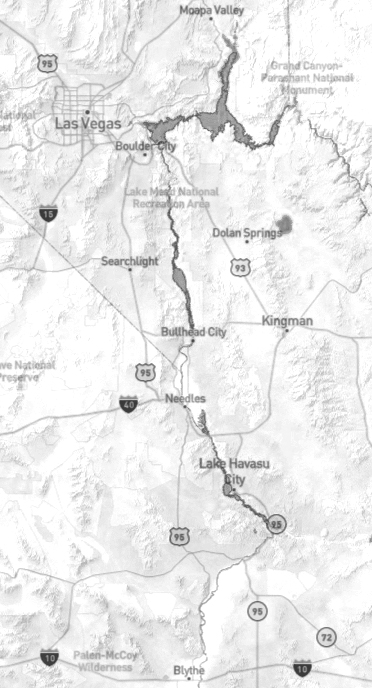
Colorado River
The Colorado River flows for approximately 1,450 miles (2,330 km). From the western slopes of the Rocky Mountains in the southwest, it supplies water to seven states. Additionally, it provides water to the Gulf of California in northwestern Mexico.
Divided into two regions, the Upper Basin encompasses Colorado, New Mexico, Utah, and Wyoming. Nevada, Arizona, and California make up the Lower Basin. Through the Rocky Mountains, it flows into the deserts of the Southwest. It is an important natural resource for agriculture, municipalities, outdoor recreation, hydropower generation, tribal nations, and drinking water for several of the nation's largest cities. They include Denver, Phoenix, and Los Angeles. In Mexico, heavy river use has depleted the lower course, so the river no longer reaches the sea in any consistent stream.
Above Hoover Dam
Grand Canyon to Hoover DamHoover Dam
Below Hoover Dam
Hoover Dam to Bill Williams River