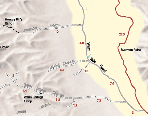
Digital-Desert : Mojave Desert >>> Route 66 <<<
From the Heartland to the Coast
Photography by
Walter Feller
features - ecology: wildlife - plants - geography: places - region map - map/sat - roads & trails: route 66 - video - aerial - 360 photos - old west - communities - lodging
ghost towns - gold mines - parks & ...: joshua tree - death valley - mojave preserve - wilderness - native culture - history - geology: natural features - glossary - comments
Death Valley National Park: Backcountry Roads:

Johnson Canyon

Route #13
    Vehicle needed:
    high-clearance first 6 miles; 4x4 beyond

    Distance:
    10 miles

    Start:
    about 20 miles from either end of the West Side Road

    Camping:
    yes, after first 2 miles

    Description:
    Beyond the end of the road a 2 mile hike leads up the canyon to Hungry Bill’s Ranch, with its rockwalled terraces and fruit trees. Continue on foot up the south fork another ½ mile to several old mining prospects.
features - ecology: wildlife - plants - geography: places - region map - map/sat - roads & trails: route 66 - video - aerial - 360 photos - old west - communities - lodging
ghost towns - gold mines - parks & ...: joshua tree - death valley - mojave preserve - wilderness - native culture - history - geology: natural features - glossary - comments
Country Life Realty
Mountain Homes and Real Estate for Sale

~ Wickless Candles by Scentsy ~
The Most Wonderful Time of the Year ...
... Is here
MH Sleds
Saucer sleds for the snow
Life time guarantee!!!

Abraxas Engineering
privacy
Copyright ©Walter Feller. All rights reserved.