Digital-Desert : Mojave Desert >>> Route 66 <<<
From the Heartland to the Coast
Photography by
Walter Feller
features - ecology: wildlife - plants - geography: places - region map - map/sat - roads & trails: route 66 - video - aerial - 360 photos - old west - communities - lodging
ghost towns - gold mines - parks & ...: joshua tree - death valley - mojave preserve - wilderness - native culture - history - geology: natural features - glossary - comments
Badwater Region

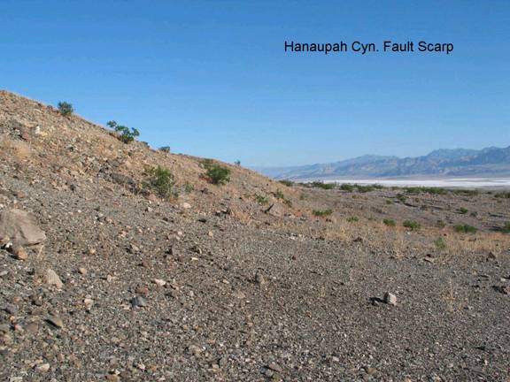
Hanaupah Canyon Fault Scarp

BW8. Location/Access:
(36o 13.119’N, 116o 53.574’W) From the Badwater Road, take the West Side Road south 10.5 miles and turn up the Hanaupah Canyon road and proceed 0.8 miles up the fan to the bluffs where the road turns south.

Best Time: Anytime, all year.

Geology: This bluff marks the trace of the Hanaupah Canyon fault. At this point it is trending N 17o E but it swings more northerly just north of here. You are near the southern end of the scarp. The fault offsets all but the most recent gravel deposits. In addition to tectonic disruption of the fan surface, many alluvial fans and bajadas on the west side of the valley have been studied in terms of their erosional and depositional history (see for example, Duhnforth, 2007). Email us for directions to something really interesting in terms of history that lies within feet of here.


features - ecology: wildlife - plants - geography: places - region map - map/sat - roads & trails: route 66 - video - aerial - 360 photos - old west - communities - lodging
ghost towns - gold mines - parks & ...: joshua tree - death valley - mojave preserve - wilderness - native culture - history - geology: natural features - glossary - comments
Country Life Realty
Mountain Homes and Real Estate for Sale

~ Wickless Candles by Scentsy ~
The Most Wonderful Time of the Year ...
... Is here
MH Sleds
Saucer sleds for the snow
Life time guarantee!!!

Abraxas Engineering
privacy
Copyright ©Walter Feller. All rights reserved.