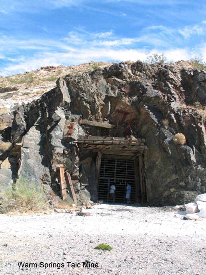
Warm Springs Talc Mines
SC4. Location/Access:(35o 58.099N, 116o 55.746W) The talc mines are located along the Warm Springs/Butte Valley road 10.8 miles up the canyon from the West Side Road, or 13.6 miles from the main paved highway just north of Ashford Mill. This site is the entrance to the largest mine in the area. You will actually pass the first mines at 8.7 miles up from the Westside Road. The Warm Springs/Butte Valley Road was in excellent condition until the mines closed in the 1980s. Since then, a high clearance vehicle would be best and four-wheel-drive is needed for travel up canyon from the mines.
Best Time: Any time in the cool half of the year.
Geology: The Warm Springs talc mines are the most recently active talc mines in the area and were a major U.S. supplier of talc until the mines closed. The mines closed not due a lack of talc but the fact that a form of asbestos was found in the talc (Van Gosen, et. Al., 2004), although apparently not a form that is injurious to health. Wright (1968) contains an excellent geologic map of the Warm Springs area showing the relationship between the Precambrian diabase sills and the intruded Crystal Spring formation (see Sites FS1-3). In this area, the total thickness of the formation is in excess of 4200ft (including the diabase, 2800ft without) (Wright, 1968). Although there are many mines in the area, the main adit at the GPS coordinates makes it clear that these were very extensive operations. Just up canyon from the main adit is Warm Spring itself, with several buildings that were constructed a few years before the mines closed.
=-=