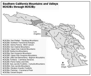
Sierra Pelona - Mint Canyon
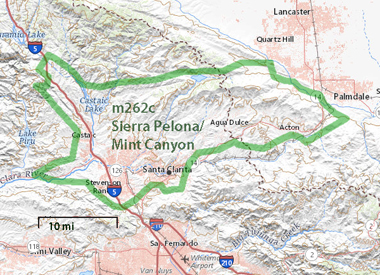
Subsection M262BcThis subsection includes the Sierra Pelona and a relatively low, but still mountainous, part of the north-northeastern Transverse Ranges between the Sierra Pelona and the San Gabriel Mountains. It is between the San Andreas fault on the east, the Santa Susana Mountains on the southwest, the Bee Canyon and Francisquito faults on the north, and Soledad Canyon on the south. The San Gabriel fault runs along the southwest border of the subsection. The climate is hot to temperate, and subhumid. MLRA 20e.
Lithology and Stratigraphy. This subsection has relatively large areas of Pre-Mesozoic plutonic rocks and gneisses, Mesozoic granitic rocks, Pre-Cretaceous Pelona schist, Oligocene volcanic rocks, Oligocene nonmarine and Miocene marine sedimentary rocks, Plio-Pleistocene sediments, and Quaternary alluvium.
Geomorphology. This is a subsection of steep mountains with narrow to rounded summits and narrow canyons, although there are a few broad valleys with Quaternary to Recent alluvial plains. The mountains trend east-west, but hills along the San Andreas fault trend west-northwest. The subsection elevation range is from about 1000 feet up to 5187 feet on Mount McDill in the Sierra Pelona. Mass wasting and fluvial erosion and deposition are the main geomorphic processes.
Soils. The soils are mostly Lithic and shallow Typic Xerorthents, shallow Entic Haploxerolls, and Mollic Haploxeralfs. Also, Lithic Haploxerolls are common on Pelona schist. Typic and Mollic Xerofluvents and Fluventic, Pachic, and Calcic Pachic Haploxerolls are common on Recent alluvial fans and floodplains. Most of the soils are leached free of carbonates. The soils are well drained. Soil temperature regimes are mostly thermic, with some mesic on north-facing slopes at higher elevations. Soil moisture regimes are xeric.
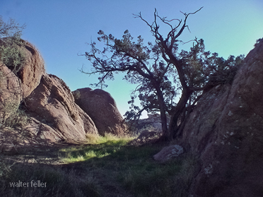
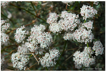
Vegetation. The predominant natural plant communities are Chamise series on shallow and very stony soils, Mixed chaparral shrublands, and Coast live oak series. Purple sage series and Mixed sage series occur at lower elevations, Birchleaf mountain-mahogany - California buckwheat series occurs on south facing slopes, and Bigcone Douglas-fir series and Bigcone Douglas-fir - canyon live oak series occur on north-facing slopes at higher elevations. California juniper series is common on the interior side of the mountains.
-
Characteristic series by lifeform include:
Grasslands: Beaked sedge series, California annual grassland series, Tufted hairgrass series.
Shrublands: Allscale series, Big sagebrush series, Birchleaf mountain-mahogany - California buckwheat series, Bitterbrush series, Black bush series, Bladderpod - California ephedra - narrowleaf goldenbush series, California buckwheat series, California sagebrush series, California sagebrush - black sage series, Chamise series, Chamise - bigberry manzanita series, Chamise - Eastwood manzanita series, Chamise - wedgeleaf ceanothus series, Chamise - white sage series, Chamise - black sage series, Cupleaf ceanothus - fremontia - oak series, Fourwing saltbush series, Hop-sage series, Mixed saltbush series, Mixed scrub oak series, Mountain whitethorn series, Mulefat series, Nolina series, Purple sage series, Scalebroom series, Scrub oak series, Shadscale series, White sage series.
Forests and woodlands: Black oak series, Birchleaf mountain-mahogany series, California juniper series, Canyon live oak series, Coast live oak series, Curlleaf mountain-mahogany series, Coulter pine series, Coulter pine - canyon live series, Singleleaf pinyon series.
Surface Water. Runoff is rapid. All but the larger streams are dry through the summer. Most of the streams drain through the Santa Clara river to the ocean, but those near the San Andreas fault drain into closed drainage basins. Natural lakes are absent, except along the San Andreas fault. There are numerous sag ponds along the San Andreas fault.
San Andreas Fault
Transverse Ranges
San Gabriel Mountains
Vasquez Rocks
Vegetation
 California buckwheat
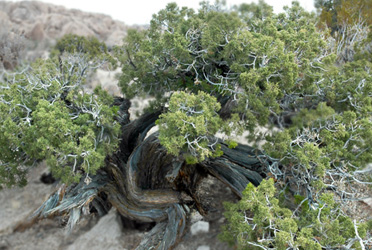
California juniper