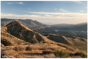
Cajon Pass
(El Cajon de los Mejicanos, La Puerta del Cajon; Paso del Cajon).Paralleled by the modern freeway through the San Gabriel Mountains. Two passes in the same vicinity have been called by the name "cajon" and three passes occur in the same area. The major pass, in use today, is the old pass of the Spanish period, level, relatively easy to ascend, suitable for wagons and horses as well as foot traffic. It follows Cajon Wash (cf . GLO Plat T 3 N 6 W, 1885).
In 1875 the proposed Los Angeles and Independence Railroad began construction in the Cajon. A tunnel and short section of road were built before work was halted due to a financial panic and the decline of ores at Panamint. The old works are found on the GLO map for T 3 N 6 W, 1885, sec. 5,6, 7, 8. This narrow portion of the pass was referred to as Tollgate Canyon (Nadeau 1865b, pp. 200-201).
The Spanish and Mexican governments occasionally maintained a military check-point here to guard against the unwanted incursions of desert Indians who raided the mission. Zalvidea's 1806 note of a Camp Cajon may have been in this canon rather than on the Mohave Indian route described below, #3 9. At the height of activity along the Spanish Trail, Mexican authorities conducted brand inspections at Cajon Pass (cf. Warner in re 1841/42 Workman-Rowland party) , probably at this site. The narrow pass would allow rigorous control of a horse herd and permit its careful inspection.
As with other major east-west trails across the California desert, this route was first developed by Indian traders. Many side trails branched from the main trail along the intermittent streams, penetrating into remote desert fastnesses not explored by whites until the mid 19th century. Using the reliable waters of the Mojave River, however, a route was successfully blazed across the desert between Santa Fe, New Mexico and Los Angeles, California in 1829-30, following the north fork of the old Indian trail. This route would serve immigrants to southern California in the 1830's and 1840's. Initially they were primarily New Mexicans relocating in California. After 1848, Mormon converts moved from west to east along the trail across the Mojave, and finally Mormon freighting companies would develop the trail into an important wagon road linking Salt Lake City and San Pedro Harbor.
The southern fork of this route led to the Mohave Indian villages at The Needles. It was this route that was first travelled by Jedediah Smith in 1826, opening up the entire region to exploration and eventual settlement. The southern fork would became an early important east-west link between the states and California, and ultimately be selected for the southern route of the railroad. Because of its early importance for overland travel, there would be military camps and a fort erected along this route, and the first federal funds for construction of a desert road would be spent to dig wells and provide suitable grades for wagon travel; it would become Old Government Road.
After the development of mining in the eastern Mohave in the 1870' s lesser used wagon roads would be opened up connecting the two forks of the road at the eastern edge of the desert, joining the Salt Lake Road and the Fort Mojave Road just west of the California border.
Portions of the trail were explored under the Spanish and Mexican governments. However, their excursions were generally limited to punitive expeditions against marauding Indians from the interior or escapees from the coastal missions. There was no attempt at settlement nor regular travel through the region via this route. For the Spanish, the trail was opened by Fr. Francisco Garces in 1776. Garces was massacred at the Yuma missions only a few years later, in 1781. Had he not suffered such an untimely death, perhaps the trail would have been put to greater use by the Spanish and Mexican forces.