Joshua Tree National Park - Geology & the Environment:
Fault Zones of Joshua Tree
North America is moving westward over the Pacific Plate at one or two inches per year. When tension builds in rocks from this collision, the strain is released along faults in the form of earthquakes, as the rocks finally break.Joshua Tree is crisscrossed with hundreds of faults, and is a great place to see raw rocks and the effects of earthquakes. The famous San Andreas Fault bounds the south side of the park, and can be observed from Keys View. Blue Cut Fault in the center of the park can be seen from the hilltop behind Lost Horse Mine. The fault forms the straight, abrupt base of the Hexie Mountains east of Queen Valley.
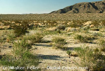
Fault zones are important factors in localizing natural springs. Movement by faults causes impervious zones of shattered rock fragments to form an underground dam forcing ground water to rise. The Oasis of Mara at the visitor center in Twentynine Palms marks the Pinto Mountain fault. The park has four other fault-caused oases that support the native palm tree, Washingtonia filifera. These oases supply food and water to a wide variety of wildlife and point to the connection between the park�s geology and its wildlife habitat.
Will Joshua Tree National Park experience a large earthquake anytime soon? Despite a great amount of recent seismic research, no one can yet predict earthquakes with any accuracy. The earth will continue to shake in Southern California, and most earthquakes will be small� �felt� by seismographs, rarely by people. Occasionally, a larger one will occur, but when or where remains unknown.
Also see:
Earthquakes & Faults
California straddles the juncture of two great crustal plates: the Pacific plate and the North American plate. ...The Mojave Block
The Mojave is a broad interior region of isolated mountain ranges separated by expanses of desert plains. It has ...San Andreas Fault
The presence of the San Andreas fault was brought dramatically to world attention on April 18, 1906, when ...Pleasant Valley
Stop #10, Geology Road Tour - The Blue Cut fault is an earthquake fault that runs for about 50 miles through the ...Adapted from Geology Road Tour Guide - NPS
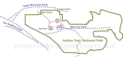
General Fault Map of Joshua Tree
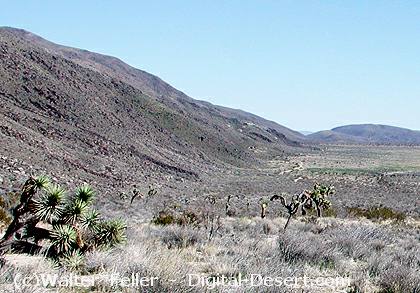
The Blue Cut Fault along the base of the Hexie Mountains
Pinto Mountain Fault (outside of the park)
