Lavic Lake
The Lavic Lake volcanic field was considered to contain four Holocene cinder cones, three in the Lavic Lake area and a fourth in the Rodman Mountains 20 km to the west (Miller 1989). Pisgah Crater, a 100-m-high cinder cone, is the most prominent feature of the basaltic lava field. Nearby vents were the source of dominantly pahoehoe lava flows that traveled 8 km SE to Lavic Lake and in a narrow lobe over that traveled over alluvial-fan and playa-lake deposits as far as 18 km west of the vent. More recent work indicates a convergence of dates for Pisgah Crater from paleomagnetic, argon-argon, and cosmogenic helium at about 25,000 years BP (Reid 2002, pers. comm.). Another very youthful looking, but undated cinder cone and lava field of the Lavic Lake volcanic field is located in the Sunshine Peak area of the Lava Beds Mountains, south of the better known Pisgah Crater.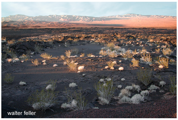
Pisgah Crater is the most prominent feature of the Lavic Lake volcanic field, which contains four Quaternary cinder cones. The 100-m-high Pisgah Crater and its surrounding 100-sq-km lava field are easily seen from nearby Interstate highway 40. The crater and nearby vents were the source of dominantly pahoehoe lava flows that traveled as far as 18 km NW over alluvial-fan and playa-lake deposits. Pisgah Crater was initially considered to be Holocene in age, but more recent dating indicates it is about 25,000 years old.
Country: United States
Subregion Name: California (USA)
Volcano Number: 1203-19-
Volcano Type: Volcanic field
Volcano Status: Holocene?
Last Known Eruption: Unknown
Summit Elevation: 1495 m 4,905 feet
Latitude: 34.75°N * 34°45'0"N
Longitude: 116.625°W 116°37'30"W
volcano.si.edu/