Long Valley
The large 17 x 32 km Long Valley caldera east of the central Sierra Nevada Range formed as a result of the voluminous Bishop Tuff eruption about 760,000 years ago. Resurgent doming in the central part of the caldera occurred shortly afterwards, followed by rhyolitic eruptions from the caldera moat and the eruption of rhyodacite from outer ring fracture vents, ending about 50,000 years ago. During early resurgent doming the caldera was filled with a large lake that left strandlines on the caldera walls and the resurgent dome island; the lake eventually drained through the Owens River Gorge. The caldera remains thermally active, with many hot springs and fumaroles, and has had significant deformation, seismicity, and other unrest in recent years. The late-Pleistocene to Holocene Inyo Craters cut the NW topographic rim of the caldera, and along with Mammoth Mountain on the SW topographic rim, are west of the structural caldera and are chemically and tectonically distinct from the Long Valley magmatic system.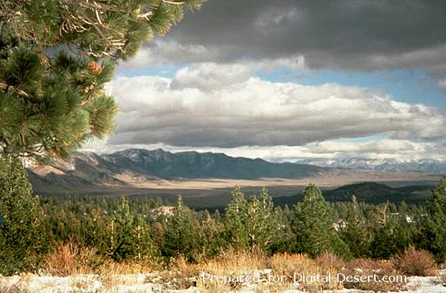
The NE caldera wall of the 17 x 32 km Long Valley caldera, seen from Lookout Mountain on the west, forms a curved ridge that rises more than 1 km above the caldera floor. The caldera was formed following the eruption of the voluminous Bishop Tuff about 760,000 years ago. Uplift and renewed eruptions then formed a resurgent dome in the center of the caldera. The caldera is thermally active and has been the site of seismic swarms and other unrest for more than a decade.
Photo by Larry Mastin, 1991 (U.S. Geological Survey).
Country: United States
Subregion Name: California (USA)
Volcano Number: 120314-A
Volcano Type: Caldera
Volcano Status: Pleistocene-Fumarolic
Last Known Eruption: Pleistocene
Summit Elevation: 3390 m 11,122 feet
Latitude: 37.70°N 37°42'0"N
Longitude: 118.87°W 118°52'0"W