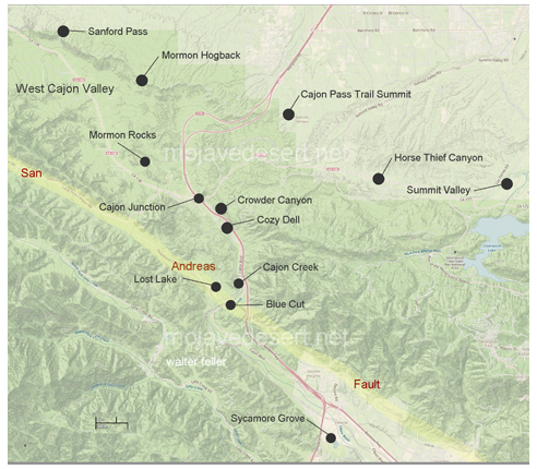
Lost Lake
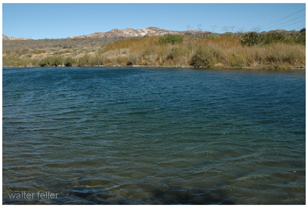
Springs will often form along faultlines because of the unconformity the fault produces allowing the groundwater to percolate to the surface. When a spring on the fault comes up in a low spot, it will pool and form a "sag pond." Lost Lake is such a sag pond forming as a result of the San Andreas fault.
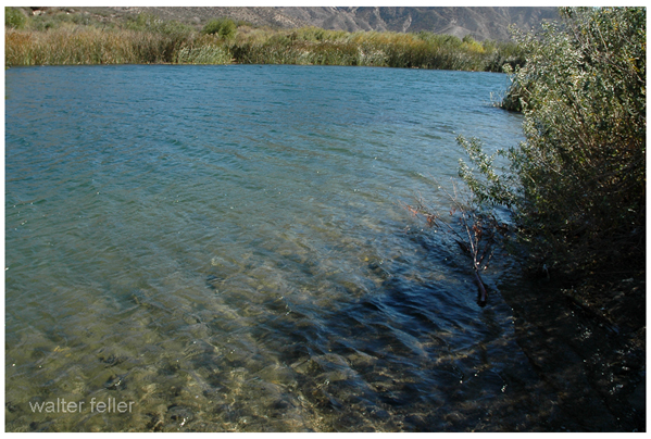
STOP A1: LOST LAKE: A SAG POND ALONG THE SAN ANDREAS FAULT, TERRACE DEPOSITS
Lost Lake: A Sag Pond along the San Andreas Fault, Terrace Deposits
The sag pond at the Lost Lake is a product of groundwater seepage in an area of tectonic depression in the San Andreas Rift Zone, a linear valley in the Lone Pine Canyon. Dr. Ray Weldon conducted a detailed study of a series of stream terraces associated with Cajon Creek in the region of Lost Lake (Weldon and Seih, 1985). The work identified progressive offset of radiocarbon dated, late Pleistocene and Holocene deposits and landforms by the San Andreas fault that yielded a set of slip rates spanning the past 14,400 years. Near Lost Lake they determined a slip rate for the San Andreas fault of ~24 mm/yr for the past 14,400 years and inferred that this slip rate had remained relatively constant during that period of time. The primary data utilized was the identification of a series of stream terraces associated with Cajon Creek that had been progressively offset by the San Andreas fault.
Their findings provided strong constraints on the local kinematics of the San Andreas Fault System in the area. For example, other work by Weldon and others determined a slip rate on the San Andreas fault approximately 10 miles northwest near Wrightwood of ~34 mm/yr which is north of the juncture between the San Jacinto and San Andreas faults. They postulated that the total slip of 34 mm/year near Wrightwood was portioned between the San Jacinto and San Andreas faults in the area of Cajon Valley. The estimated slip rate for the local San Jacinto fault zone is 10 mm/yr, which once added to the estimated 24 mm/yr totaled 34 mm/yr.
Figure 4. Lost Lake Sag Pond: Groundwater seepage in the tectonic depression in the San Andreas fault zone has created the pond, here covered with cattails along the shore.
Geology and Hydrology in the Eastern San Gabriel Mountains
Miles Kenney and Robert Reynolds
Also see:
Springs & Oases
-
A spring is the result of an aquifer being filled to the point that the
water overflows onto the land surface. There are different kinds ...
San Gabriel Mountains
-
This subsection comprises the lower and warmer parts of the San Gabriel Mountains, which are ...
