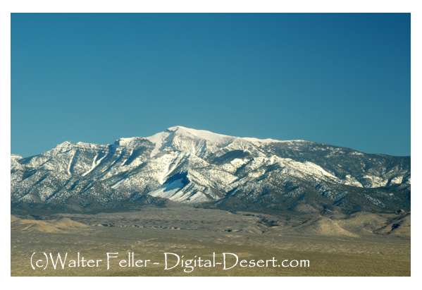
Mt. Charleston

Elevation 11,918 feet
Just 45 minutes from Las Vegas, the Mt. Charleston Wilderness feels like it is worlds away from the city with invigorating mountain air, ice-cold springs and evergreen forest amid the Spring Mountain National Recreation Area. This cool-weather oasis boasts a combined total of 56,018 acres and is jointly managed by the U.S. Forest Service and Bureau of Land Management.
Mt. Charleston is known as a sky island because of its high elevation and isolation from the drastically different desert lowlands. This wilderness extends along the crest of the mostly north-south Spring Mountains with towering cliffs, deep narrow canyons, steep hillsides and barren wind-swept summits. The landscape, ranging from 4,440 to 11,916 feet in elevation, showcases a variety of lifezones, plants and animals. The Spring Mountains are also home to several endemic plants and animals.
Over 18,000 acres of bristlecone pine trees, the most extensive stand of these trees in the Intermountain West, cover the lower ridges. These ancient trees bring an added touch of beauty and awe, with at least one tree known to be nearly 3,000 years old.
This stunning wilderness area provides much-needed respite from the summer desert heat for both humans and wildlife alike, hosting the only herd of Rocky Mountain elk in Clark County. As you leave the valley floor and travel up in elevation, to you will see creosote bush, Joshua trees, pinyon pines, Utah juniper, sagebrush, ponderosa pine, manzanita, shrub live oak, white fir, limber pine, quaking aspen, bristlecone pine, and at the highest elevations only low shrubs, grasses, and forbs.
With a watchful eye you may be able to spot white-tailed antelope squirrels, black-tailed jackrabbits, kit foxes, burros, elk, Palmer’s chipmunks, mule deer, mountain lions, golden mantle ground squirrels, rock wrens, red-tailed hawks, Stellar’s jays, mountain chickadees, juncos, broad-tailed hummingbirds, and white-throated nuthatches.
Directions
The summit of Mt. Charleston sits near the center of the wilderness area, with six lobes extending away from the peak along the high-elevation mountain ranges. Between these lobes, several roads allow access to various parts of the wilderness. Paved roads lead into Kyle and Lee canyons.
Access is also provided by several dirt roads, including the Harris Canyon Road, the road above Cold Creek, and several roads on the west side of the mountains.
Recreation
The Mt. Charleston Wilderness provides a unique and beautiful backdrop for both summer and winter recreation. Explore the high country with a hiking, horseback riding, or camping trip. Nearly 40 miles of trails cover the wilderness, with significant elevation changes offering spectacular views and endless challenges. For the more adventurous, Mt. Charleston’s skiing, ice climbing, and rock climbing are sure to please. Backcountry permits are not required. Motorized vehicles, mechanized equipment, and mechanical transport are not permitted in designated wilderness
Additional Information
• Please limit group sizes to 12 members
• Maximum length of stay: 14 days
• Campfires are not allowed in the Mt. Charleston Wilderness. Please use camp stoves.
• Other than incidental browsing, riding and pack stock animals may be fed only packed-in, certified, weed-free feed.
• Collection of natural resources, including wildlife (with the exception of hunting with a valid hunting license or tag), plants, rocks, or fossils in wilderness is prohibited without a valid scientific research and collecting permit.
• Collecting from or impacting archaeological sites in any way is prohibite
source - BLM
