Digital-Desert : Mojave Desert >>> Route 66 <<<
From the Heartland to the Coast
Photography by
Walter Feller
features - ecology: wildlife - plants - geography: places - region map - map/sat - roads & trails: route 66 - video - aerial - 360 photos - old west - communities - lodging
ghost towns - gold mines - parks & ...: joshua tree - death valley - mojave preserve - wilderness - native culture - history - geology: natural features - glossary - comments
Death Valley Geology : Sand Dunes

Panamint Dunes

Travelers crossing Panamint Valley on Hwy. 190 may view these dunes as a distant, pale smudge to the north. Those wanting a closer look must drive 5 miles down the unmarked dirt road leading past Lake Hill, then hike cross-country 3 miles. The other dunes of Death Valley are all situated on flat valley floors, but these are perched on a slope. The view from the summit of these dunes reveals their star shape and an impressive view down the valley.
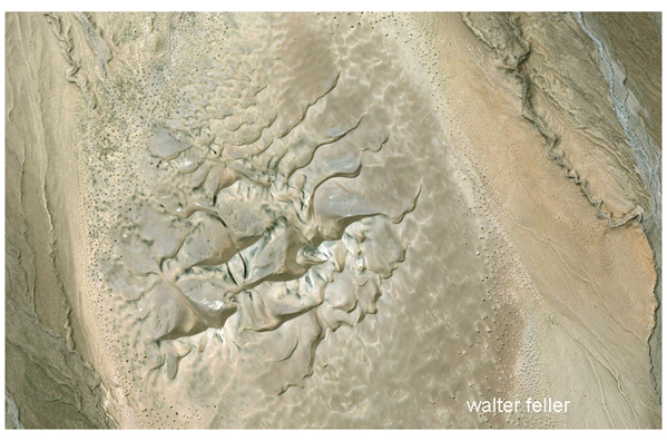


source: National Park Service

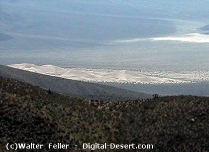
Panamint Sand Dunes as seen from Grapevine Pass

features - ecology: wildlife - plants - geography: places - region map - map/sat - roads & trails: route 66 - video - aerial - 360 photos - old west - communities - lodging
ghost towns - gold mines - parks & ...: joshua tree - death valley - mojave preserve - wilderness - native culture - history - geology: natural features - glossary - comments
Country Life Realty
Mountain Homes and Real Estate for Sale

~ Wickless Candles by Scentsy ~
The Most Wonderful Time of the Year ...
... Is here
MH Sleds
Saucer sleds for the snow
Life time guarantee!!!

Abraxas Engineering
privacy
Copyright ©Walter Feller. All rights reserved.