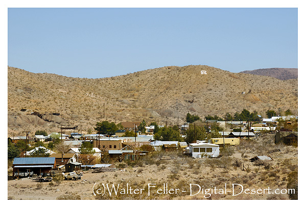
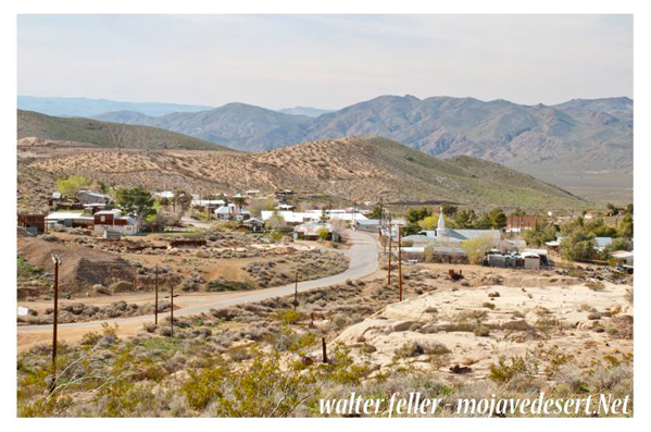
Randsburg, CA.
Rand Camp began as a tent city, erected by eager miners rushed to the Mojave desert following a major gold discovery in April 1895.
A year later, the town of 1,500 had been renamed "Randsburg."
Saloons sprouted, a U.S. Post Office was established, and the communities first newspaper, "The Randsburg Miner," appeared.
By 1900, Randsburg's 3,500 inhabitants had a 30-stamp ore crusher, bank, churches and theaters.
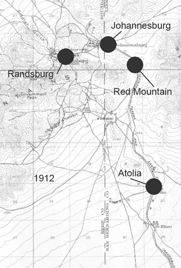
Railroad tracks soon connected the nearby town of Johannesburg to Kramer's Junction, some 25 miles to the south.
At the turn-of-the-century, when gold was worth only $12-$16 an ounce, Randsburg's famous Yellow Aster Mine recovered $3 million in gold.
In 1911, to take was $6 million. Most of the visible, or free gold, in the Rand Mining District already had been found before World War II, when gold mines nationwide were classified as "non-essential" industries, and closed.
Technological developments now overshadow earlier methods of extracting free gold and make recovery of microscopic gold from low-grade ores economically feasible.
During boom and bust, fires and war, smallpox and influenza epidemics, Randsburg tenaciously has clung to life.
It still does.
source - BLM
Randsburg Weather
Historical Timeline
1893: Prospectors were already combing the Mojave Desert when gold was found at Goler Wash, setting off the first wave of attention in what would soon become the Rand Mining District.April 1895: John Singleton, Charles Burcham, and Frederic Mooers hit a rich vein of gold on Rand Mountain. That claim became the Yellow Aster Mine one of the most productive gold mines in Southern California. Their find kicked off a real gold rush.
December 1895: A tent city quickly sprang up around the Yellow Aster and was called Rand Camp. Miners, merchants, and all kinds of frontier folks came pouring in, setting up saloons, stores, and makeshift homes.
1896: Rand Camp was officially renamed Randsburg, and a post office was established a sure sign that this dusty camp had grown into a town.
1897: The Randsburg Railway connected the town to Kramer Junction, making it easier to haul ore and supplies in and out. It was a vital link that kept the boom going strong.
1898: Two devastating fires tore through town. One burned half the buildings; the other followed just months later, destroying much of what had been rebuilt. But the town bounced back as mining towns often did.
1903: Workers at the Yellow Aster Mine went on strike, protesting poor wages and conditions. Like many Western mining towns, labor tension simmered just under the surface.
1918: The Yellow Aster Mine shut down operations. It reopened briefly in 1921, but by 1933, it closed for good as the Great Depression and falling ore prices took their toll.
1933: The Randsburg Railway ceased operations that same year. The boom days were over, and the desert began to reclaim its silence.
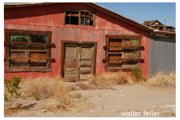
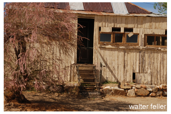
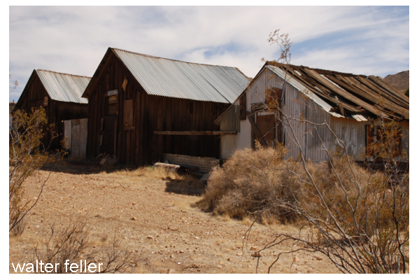
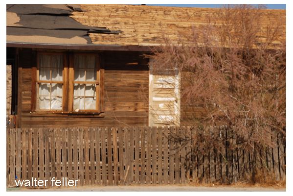
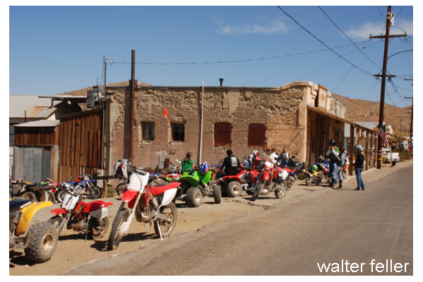
Present Day: Randsburg is a living ghost town with a population of around 45 people. On weekends, motorcyclists and tourists stop in to explore old buildings, visit the general store, and soak in the frontier feel. Its a place where the Wild West never quite faded it just got a little quieter.
---------
Yellow Aster
Heritage of the Upper Mojave
"It is a land steeped in the romance and lore of a colorful past which witnessed a cavalcade of pathfinders, explorers, gold seekers, stagecoaches, and freighting wagons -- culminating with the entrance of railroads, ..."C.W. Tucker Photos
Photographs made by C. W. Tucker, Randsburg photographer circa 1896 - 1898Historic Randsburg Photos
Burton Frasher photos - 1934History of Randsburg Mining District
Wandering prospectors from the El Paso District discovered that the Summit Range, located northeast of the El Paso Mountains, also contained ...Atolia-Randsburg Tungsten Boom
Randsburg by the beginning of the twentieth century has settled into a calm period of average, modest mining production. No new gold discoveries ...Randsburg Railway
Randsburg, California, is a historic mining town located in the western Mojave Desert. Founded in 1895, the town experienced a boom during the gold rush era thanks to the discovery of the Yellow Aster Mine.
The Yellow Aster Mine, located just outside of Randsburg, was one of the richest gold mines in California. It was discovered in 1895 by two prospectors, Singleton and Burcham. The mine got its name from the bright yellow color of the ore, which was a telltale sign of its high gold content.
The Yellow Aster Mine quickly became a major producer of gold, attracting miners from all over the country. In its early years, the mine yielded an impressive amount of gold, making it one of the most profitable mines in the region. Over $20 million worth of gold was estimated to be extracted from the mine during its operation.
The success of the Yellow Aster Mine spurred Randsburg's growth as miners flocked to the area in search of fortune. The town quickly developed into a bustling community with saloons, stores, and other amenities. At its peak, Randsburg had 4,000 residents.
However, like many mining towns, Randsburg experienced a decline as the gold reserves in the Yellow Aster Mine dwindled. By the early 1900s, the mine's production had significantly decreased, leading to a decline in the town's population and economic activity.
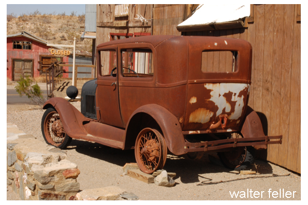
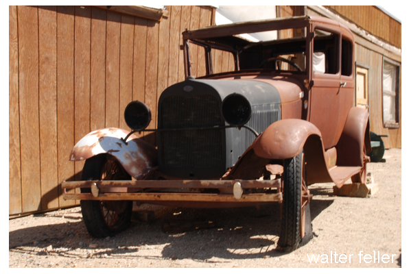
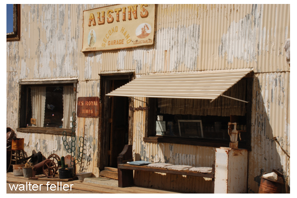
Today, Randsburg and the Yellow Aster Mine serve as reminders of California's rich mining history. The town has preserved its historic charm, with many of its original buildings still standing. Visitors can explore the streets of Randsburg, taking in the old-time atmosphere and learning about the town's mining past.
Randsburg offers other attractions for visitors. The town is known for its off-roading opportunities, with miles of desert trails for ATV and dirt bike enthusiasts. There are also antique shops and galleries for browsing unique finds.
Randsburg, California, and the Yellow Aster Mine are a testament to the perseverance and determination of the early miners who sought their fortune in the Mojave Desert. By preserving their history, we can appreciate the challenges they faced and their impact on the region's development.