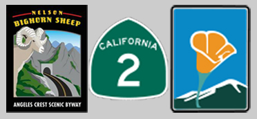
Angeles Crest Scenic Highway 2
Dawson Saddle
Introduction
The Angeles Crest Scenic Byway was designated a California State Scenic Highway on March 12, 1971 and a National Forest Scenic Byway on October 5, 1990. This 55-mile stretch of California State Route 2 travels through the San Gabriel Mountains and provides access to spectacular scenery, geological features, historic sites, recreational opportunities, important ecological and biological areas, and mountain communities within driving distance of Los Angeles. The western terminus begins in La Canada Flintridge, California in the greater Los Angeles Basin, and extends north and east through the Angeles National Forest to the Los Angeles/ San Bernardino County line west of Wrightwood, California.California, an early leader in the scenic highway program, has more than fifty designated state and national scenic routes, including the Angeles Crest Scenic Byway. The California State Scenic Byway Program was established in 1963 to preserve and protect scenic highway corridors from change which would diminish the aesthetic value of lands adjacent to highways. California State Scenic Byways are marked with highway signs depicting the state flower, an orange poppy.
--
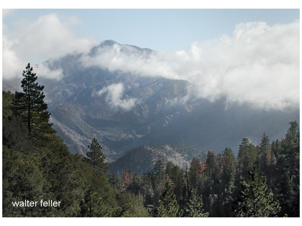
The Angeles Crest Scenic Byway remains the primary means of entering the San Gabriel Mountains. Overlooking the Los Angeles Basin to the south and west, San Fernando Valley to the west, San Gabriel and Pomona Valleys to the south and the Mojave Desert to the north, the byway offers visitors spectacular, diverse views.
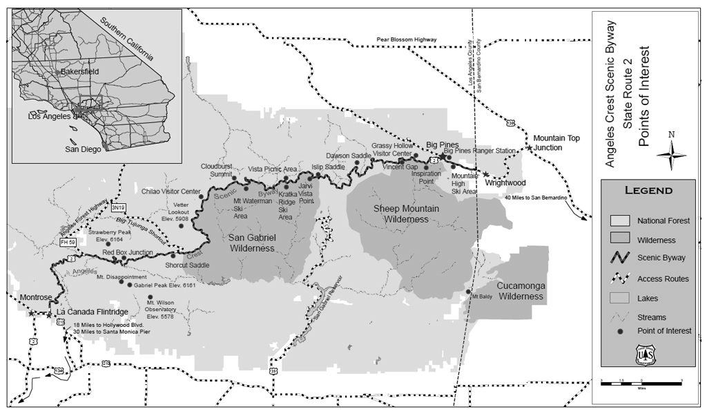
Motorists can access the Angeles Crest Scenic Byway on the west from Foothill Boulevard, off of Interstate 210, in La Canada Flintridge or from Route 2 on the east, near Wrightwood, California. The official state scenic designation begins at the intersection of Foothill Boulevard and ends at the Los Angeles/San Bernardino County line, west of Wrightwood. The National Forest Scenic Byway designation begins at the Angeles National Forest boundary and ends with the state designation.
Uniquely, the Angeles Crest Scenic Byway is on the edge of the Los Angeles basin where over 20 million people reside. Because of this route, one can surf in the Pacific Ocean and snowshoe in the San Gabriels in the same day. The byway connects urban areas of traffic congestion, pavement, and manicured lawns with the contrasting natural environment of oak thickets, chaparral, high desert landscapes, pine forests, and wilderness areas. From a bustling city environment to solitude within an hour drive, visitors can take refuge within the Angeles National Forest.
History of the Angeles Crest Scenic Byway
Visions of a great mountain highway over the crest of the San Gabriel mountain range attracted interest in the early 1900s. In 1915, the famous Rim of the World Drive was constructed through the San Bernardino Mountains, further encouraging the development of other mountain highways. Local citizens envisioned the San Gabriel route as the most scenic and picturesque mountain road in the state (Robinson, 1991, p. 197). The original intent was to intersect these routes. Preliminary feasibility surveys began in 1915 and continued through 1919. Support grew and money was allocated to begin the project, but disagreements on route location, safety standards, and funding delayed construction. During 1919 and 1924, wildfires provided forest supervisors a new reason to build the route: to transport supplies to wildland fire crews. The Forest Service constructed fireroads in 1925 cut out of the mountainside (Robinson, 1991, p. 197). The H. W. Rohl Company was awarded the contract to construct the initial 2.6 miles of Route 2 in 1929. Labor camps were established at points along the highway between 1930 and 1933 to alleviate unemployment in Los Angeles and bring a workforce to the area. Starting in 1932, prison labor was also used to complete the highway. By 1936, three County prison companies housed in camps were working on different sections along the Angeles Crest and the Angeles Forest Highways. One camp, based at Kentucky Springs, worked up Aliso Canyon toward Mill Creek Saddle. A company housed in upper Big Tujunga Canyon, constructed the middle portion. The third group, based out of Clear Creek detention camp, worked west and north from Clear Creek Junction on the Angeles Forest Highway (Robinson, 1991. p. 201). Honor camps, as they were called, were used until 1942, when the U.S. entered World War II, and were reopened in 1946. One camp even housed a school for the children of civilian employees. Employees working out of Camp 37 were responsible for constructing the two tunnels along the byway, 680 feet and 470 feet in length.In 1956, after nearly a half-century of planning, fundraising, and construction, the Angeles Crest Highway was completed through Wrightwood. The heart of the once primitive San Gabriels was open to the masses. The Angeles National Forest Supervisor William V. Mendenhall named the route the Angeles Crest Highway (Robinson, 1991, p. 198).
Several historic landmarks located along the route provide a unique look into the past. The Mount Wilson Observatory, founded in 1904, is located on the summit of Mt Wilson at 5715 feet in elevation. This premier astronomical observatory is home to the world-famous Hooker 100-inch telescope and many important discoveries. With numerous cell, radio, and televisions towers, the current skyline above Pasadena is distinctly different than it was over one hundred years ago.
Some of the many historic landmarks along the Angeles Crest Scenic Byway include Red Box Junction, Charlton-Chilao Recreation Area, Shortcut S Vetter Lookout, Newcom Ranch Inn, Islip Saddle, Vincent Gap, and Big Pines. Every peak also has a story to tell. At Red Box Junction, visitors can see Mt. Disappointment and San Gabriel peaks. They were named in 1875 by a US Army Wheeler Survey after discovering that Mt. San Gabriel was taller than Mt. Disappointment, which had been set up as the original triangulation point.
Views from the byway let road travelers feel the vast, ruggedness of these areas while the more adventurous can explore within. Recreationists can hike historic trails and experience the San Gabriel and Sheep Mountain Wilderness Areas from the Angeles Crest Scenic Byway. The 2665-mile Pacific Crest National Scenic Trail, a continuous trail from Mexico to Canada, crosses the byway in several locations. The first National Historic Trail, the Gabrielino National Recreation Trail, named for the Tongva (Gabrielino) Native American ancient trading route, is accessible near Red Box Station. Visitors can also reach the Silver Moccasin and High Desert National Recreation Trails from trailheads along the byway.
Visitors to the Angeles Crest Scenic Byway have many opportunities to camp, hike, picnic, ski, study nature or relax with friends and family. There are 13 campgrounds along or within hiking distance of th byway and cabins for rent in the town of Wrightwood. There are numerous locations where travelers can stop to rest or picnic and enjoy the clean mountain air. Turnouts and nooks along the route frame panoramic vistas of the Los Angeles Basin, and the San Gabriel and Pomona Valleys. On clear days the Santa Catalina Islands are visible in the Pacific Ocean. Miles of hiking, mountain bike riding and horse trails traverse through this landscape.
Adapted from:
Corridor Management Plan
Angeles Crest Scenic Byway - California State Route 2
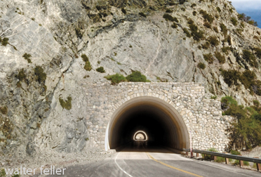
Bighorn Tunnel
Angeles Crest Scenic Highway
Points of interest along the scenic bywayAngeles Crest Road Guide
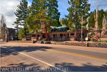
Big Pines Visitor Center