Coso Range >> Map #63
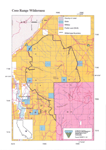
Coso Range Wilderness
SIZE: 50,520 acres
LOCATION: Inyo County; 12 miles west of Darwin, California and 6 miles northeast of Olancha, California
NATURAL RESOURCES: This wilderness encompasses the northern section of the Coso Mountain Range, an area of extensive erosion revealing outstanding volcanic displays and numerous valleys and washes. From high points within the wilderness, most notably Joshua Flat, one can obtain outstanding views of the Owens Valley and the eastern Sierra Nevadas. Creosote, low desert shrubs, annuals, cactus and large stands of Joshua trees are the primary vegetation in the area. Vermillion Canyon and Joshua Flat are two especially scenic areas within this wilderness. Cactus Flat and McCloud Flat are two areas of historic mining activity.
| GLOSSARY | > erosion, volcanic, wash, |
ACCESS: Access to this wilderness on the north and east is via State Highway 190, east of Olancha, and then along four-wheel drive routes SE9, SE10, or Centennial Canyon. Access on the west side is via U.S. Highway 395 east of Olancha and along Cactus Flat Road and numerous other four-wheel drive routes.