Death Valley National Park - Death Valley
Saratoga Springs

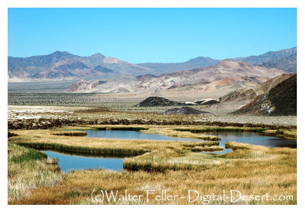
Saratoga Springs is located near the southern boundary of Death Valley National Park. Several springs feed three large open water ponds approximately 6.6 acres in size. This desert wetland supports a rich community of plants and animals. Common reeds, bulrush, and saltgrass provide food and shelter for many of the animals living here.
Saratoga Springs is also home to the Saratoga Pupfish
(Cyprinodon nevadensis nevadensis) an endemic Death Valley species.
-
-
Like Ibex Springs to the north, activities at Saratoga Springs have been constant and varied over the last hundred years, for the springs have long been the most important watering spot in the south Death Valley region. As with Ibex Springs, little remains to bear witness to Saratogas past, due to the destruction wrought by years of harsh weather and the sticky hands of generations of prospectors and travelers.
The first printed mention of Saratoga Springs is connected with the 1871 Wheeler survey. Although accounts are somewhat contradictory, a portion of the Wheeler party apparently camped at the springs, and named them after the well-known resort of Saratoga Springs, New York. Whether or not the springs were first discovered by Wheelers party, they soon became known to travelers, teamsters and prospectors of the desert region, and were important desert stops for all. Although the accounts again vary, the springs were a primary watering hole for the famous 20-mule team borax wagons during the 1880s, as they were on the direct route from the old Amargosa borax works, and the alternate route for the Harmony borax works of Death Valley. [19]
- NPS, Death Valley: Historic Resource Study - A History of Mining
Saratoga Springs Geology
Geology: Saratoga Springs is probably the best spring in Death Valley. The large pools are partially the result of ...Death Valley Ecosubsection
This subsection is the alluvial plain of Death Valley, from Sand Spring south-southeast to the drainage divide between Death Valley ...Ibex Springs
In brief, the South Valley and Ibex Hills region has seen periods of short and intermittent ...Moorehouse Mine
The last stage of mining activities in south Death Valley opened in the mid-1930s, when ...Ibex Dunes
Visitors to Saratoga Springs may notice these dunes, but they are shielded from paved roads by ...Amargosa River
Amargosa is nearly 200 miles long, but by the time the river terminates, it has only traveled ...


