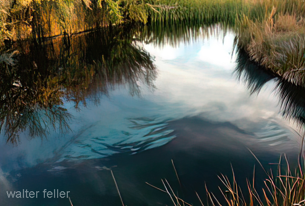
Refuge Habitat
Ash Meadows National Wildlife Refuge (NWR), located 90 miles northwest of Las Vegas, NV
encompasses over 22,000 acres of spring-fed wetlands and
alkaline
desert uplands. The
Refuge is a major discharge point for a vast underground aquifer system stretching 100
miles to the northeast. Water-bearing strata comes to the surface in more than 30 seeps
and
springs,
providing a rich and complex variety of
habitats.
Over 10,000 gallons per
minute flow year round, most of which comes from seven major springs: Fairbanks, Rogers,
Longstreet, Crystal, Point of Rocks, Jackrabbit, and Big Springs. The reason for this
abundance of water in an otherwise dry and desolate region is the presence of a geological
fault.
The movement of this particular fault acts as an "underground dam," blocking the
flow of water and forcing it to the surface. The water arriving at Ash Meadows is called
"fossil" water, because it is believed to have entered the ground water system thousands
of years ago.
Water is the key natural resource that makes Ash Meadows a unique
ecosystem
in the dry
Mojave Desert. Where does it come from? Over 100 miles to the northeast, water enters a
vast underground aquifer system. This water, also known as "fossil water", takes thousands
of years to move through the ground. Ageological fault acts as an "underground dam" blocking
the flow of the water and forcing it to the surface into 30 seeps and springs. Over 10,000
gallons per minute flow year round, most of which come from seven major springs.
Wetlands, springs, and springbrook channels are scattered throughout the refuge. Sandy
dunes, rising up to 50 feet above the landscape, appear in the central portions of the
refuge. Mesquite and ash groves flourish near wetlands and stream channels. Saltbush
dominates large portions of the refuge in dry areas adjacent to wetlands.
Creosote(shrub) habitat
occurs in the drier elevated areas along the east and southeastern portions of the
refuge. Eight species of cactus occur scattered throughout the refuge.
Refuge Habitat Wildlife Wildlife Calendar Threatened & Endangered Species Plants History Restoration Quick Refuge Facts