Subsection 322Aa
Owens Valley
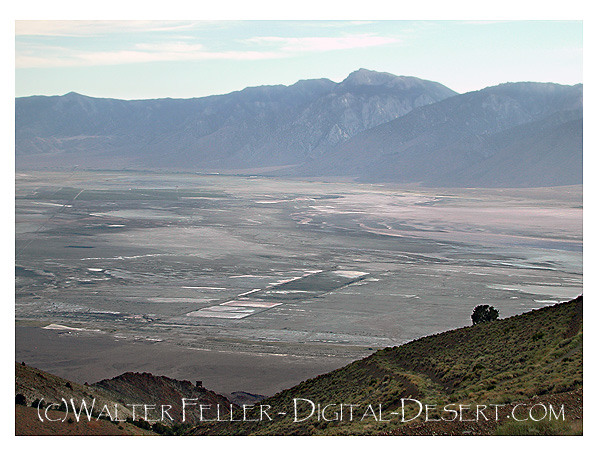
This subsection is the alluvial plain in the southern part of Owens Valley, from the Poverty Hill south to Rose Valley. It includes Owens Lake. The climate is hot and dry. MLRAs 29f and 30g.
Lithology and Stratigraphy. This subsection contains mostly Quaternary alluvial fan, basin-fill, and lacustrine deposits. There is some dune sand on the east side of Owens Lake. The Alabama Hills and Poverty Hill, which protrude up through alluvial fans of Owens Valley, are Mesozoic granitic, Jurassic - Triassic volcanic, and Pre-Cretaceous metamorphic rocks. There are flows of Quaternary basalt named Aberdeen Lava over alluvial fans in the northern part of the subsection.
Geomorphology. This subsection consists predominantly of nearly level lake plain and basin floor and gently to moderately sloping alluvial fans. Moderately steep to steep Poverty Hill and the Alabama Hills are prominent but only small parts of the subsection. The valley is oriented toward the north-northwest. The elevation range is from about 3000 to 6000 feet. Fluvial erosion and deposition are the main geomorphic processes.
Soils. The soils are mostly Xeric and Typic Torrifluvents, Xeric and Typic Torriorthents, and Xeric and Typic Haplargids on alluvial fans; and they are Typic Camborthids, Typic and Xeric Natrargids, Aquic Xerofluvents, and Aeric Haplaquepts on basin-fill. The lake plains are mostly playas that have only recently become exposed on the surface and still lack vascular plant cover. Soils on hills are mostly Lithic Torriorthents and Lithic Camborthids on granitic rocks and Lithic Torriorthents and Lithic Haplargids on other kinds of rocks. Soils that are on the rocky Aberdeen Lava are Vitrandic Torriorthents and Vitrandic Haplocambids. There are Typic Torripsamments on dune sand. All soils on the alluvial fans are well drained, but some in basin-fill are somewhat poorly to poorly drained. The soil temperature regimes are mostly thermic, and some mesic at higher elevations on alluvial fans. Soil moisture regimes are mostly aridic, and some xeric (nearly aridic). Wet soils in basin-fill generally have aquic moisture regimes.
Vegetation. The predominant natural plant communities are Mixed saltbush series and Greasewood series on basin-fill and Shadscale series and Hop-sage series on alluvial fans. Black bush series and some Sagebrush series occur at higher elevations on the alluvial fans. Creosote bush series is predominant south of Owens Lake.
- Characteristic series by lifeform include:
Grasslands: Alkali sacaton series, Desert sand - verbena series, Indian ricegrass series, Saltgrass series.
Shrublands: Allscale series, Black brush series, Desert-holly series, Fourwing saltbush series, Greasewood series, Hop-sage series, Iodine bush series, Mixed saltbush series, Rubber rabbitbush series, Scadscale series, Spinescale series.
Forests and woodlands: Curleaf mountain-mahogany series, Water birch series.
Surface Water. Runoff is rapid from alluvial fans and slow from basin-fill. The Owens River drains through the valley to Owens Lake. Owens Lake overflowed through Rose Valley to Indian Wells Valley during the Pleistocene, but not recently. Owens Lake is no longer a lake, although it has been historically. No surface water leaves the subsection naturally, but water is exported to Los Angeles.
Mojave Desert - next >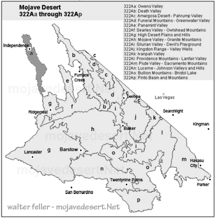
Wilderness Areas
Coso Range
This wilderness encompasses the northern section of the Coso Mountain Range, an area of extensive erosion revealing outstanding volcanic displays ...Inyo Mountains
This wilderness encompasses a large portion of the Inyo Mountains, which rise to 11,000 feet at Keynote Peak and separates ...Malpais Mesa
In this wilderness rugged valleys, deep canyons, sheer mountain sides and mesas can be found within a short distance of each other.Geomorphic Province
Basin and Range
Another graben, Owens Valley, lies between the bold eastern fault scarp of ...Other: