Furnace Creek, California
This small village, Furnace Creek, California, can be likened in appearance to a secret paradise right at the heart of one of Earth's hottest and driest places-Death Valley. In fact, it is a real oasis that features palm trees, cool pools in which to swim, and wildlife; to this effect, it is unimaginable that such a place could be set right in the middle of a desert.This has been an important area for a very long time. Water was here, well known to Native Americans, including the Timbisha Shoshone Tribe, who used it for survival. Later, in the 1800s, explorers and the famous Borax Mule Teams would rest there on cross-desert detours.
Today, Furnace Creek is a famous holiday destination for all sorts of people. It has two major places to stay: the posh-sounding Inn at Furnace Creek and the more laidback Ranch at Furnace Creek, containing everything from food to filling stations. You can hike, bike, or even play golf on the world's lowest course, which is 214 feet below sea level.
Amazingly, the night sky at Furnace Creek-so dark that you can see the Milky Way without a telescope. That's because the area is one of the rare Dark Sky Parks-meaning, this is the spot for stargazing.
There is the water that keeps alive the vegetation and animals of this oasis and maintains the pools at a very relaxing 84 degrees. Furnace Creek is one of the most extra-special stops in the desert where lots of fun can be had while learning so many historical facts and beholding some of the wonders of nature all at once.
Nearby Points of Interest and Attractions:
Furnace Creek Inn
Harmony Borax Works
Although this borax refinery operated only from 1883 to 1888, it is important as the birthplace of the famous Twenty Mule Teams. Adobe ruins and an original wagon hint at the industrial activity that once was. Interpretive signs along the short, paved trail tell the story. Located one mile north of Furnace Creek on Hwy 190 west.Golden Canyon
Hikers entering the narrows of this canyon are greeted by golden badlands within. An interpretive pamphlet is available. Hiking options include either a two-mile round-trip in Golden Canyon, or a four mile loop that returns via Gower Gulch. Trailhead located on Badwater Road.Artist's Drive
Scenic loop drive through multi-hued volcanic and sedimentary hills. Artist's Palette is especially photogenic in late afternoon light. The 9-mile paved road is one-way and is only drivable with vehicles less than 25 feet in length. Drive starts from Badwater Road.Devil's Golf Course
Immense area of rock salt eroded by wind and rain into jagged spires. So incredibly serrated that "only the devil could play golf on such rough links." The unpaved road starts on Badwater Road and is often closed after rain.Natural Bridge
Massive rock span across interesting desert canyon. From the trailhead, the natural bridge is a 1/2 mile walk. The spur road is gravel and often rough. Located off Badwater Road.Badwater
Lowest point in North America at 282 feet below sea level, Badwater Basin is a surreal landscape of vast salt flats. A temporary lake may form here after heavy rainstorms. Do not walk on the salt flats in hot weather.Zabriskie Point
Surrounded by a maze of wildly eroded and vibrantly colored badlands, this spectacular view is one of the park's most famous. Zabriskie Point is a popular sunrise and sunset viewing location. The viewpoint is a short walk uphill from the parking area. Located east of Furnace Creek on Hwy 190.Dante's View
The most breathtaking viewpoint in the park, this mountain-top overlook is more than 5000 feet above the inferno of Death Valley. The paved access road is open to all vehicles less than 25 feet in length and starts east of Furnace Creek on Hwy 190.Twenty Mule Team Canyon
Winding through otherworldly badlands, this 2.7 mile, one-way loop drive is unpaved, but accessable to all standard vehicles other than buses, RVs, and trailers. Located off Hwy 190, east of Furnace Creek.-
Regional Ecosubsection
Mojave Desert - Death Valley
This subsection is the alluvial plain of Death Valley, from Sand Spring south-southeast to the drainage divide between Death Valley and Silurian Valley. Regional GeologyFurnace Creek Wash
... located just southeast of the central headquarters and village area of Furnace Creek. ...Central Death Valley
The sites emphasize mining history, evidence of climate change since the Pleistocene and Neogene extensional tectonics. ...Badwater Region
These sites can be visited while in transit between Furnace Creek and Shoshone or are all within a short easy drive from Furnace Creek. ... Highways:State Route 190
The Death Valley Scenic BywayHistory of Furnace Creek Ranch
Clickable Map of Furnace Creek Area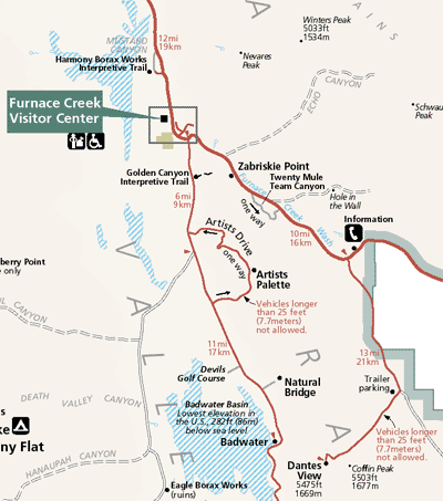 Zoom out to the Map of Death Valley
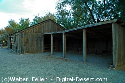
Blacksmith shop at Furnace Creek Museum
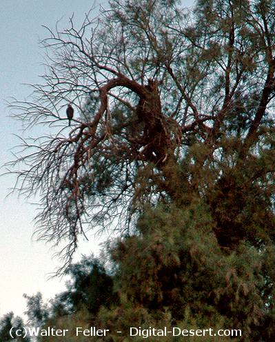
A red-tailed hawk bides its time waiting for the glimspe of a meal in the distance from the top of a tamarisk tree at Furnace Creek
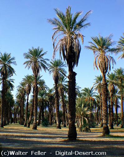
Date palm trees at the Furnace Creek Ranch
