| Digital-Desert : Mojave Desert |
Photography by Walter Feller |
Visit us on Facebook |
| features - ecology: wildlife - plants - geography: places - region map - map/sat - roads & trails: route 66 - old west - communities - miscellaneous |
| ghost towns - gold mines - parks & ...: joshua tree - death valley - mojave preserve - wilderness - native culture - history - geology: natural features - glossary - comments |
|
|
Wilderness - MAP 
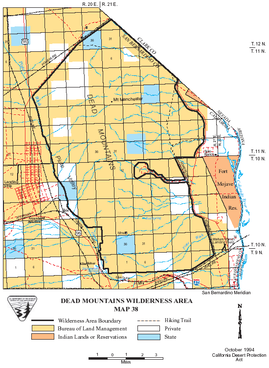
Dead Mountains >> Map #38 Dead Mountains Wilderness SIZE: 48,850 acres LOCATION: San Bernardino County; 12 miles northwest of Needles, California ACCESS: A popular access to the Dead Mountains is to hike south from the segment of the Mojave Road that parallels the Nevada State line, which also forms the northern boundary of the wilderness. To locate the Mojave Road, go approximately 16 miles north from Needles, California on River Road (PEW Road on 7.5 maps). Turn west at the rock cairn and travel up the wash.
|
| features - ecology: wildlife - plants - geography: places - region map - map/sat - roads & trails: route 66 - old west - communities - miscellaneous |
| ghost towns - gold mines - parks & ...: joshua tree - death valley - mojave preserve - wilderness - native culture - history - geology: natural features - glossary - comments |
|
Country Life Realty Mountain Homes and Real Estate for Sale |
~ Wickless Candles by Scentsy ~ The Most Wonderful Time of the Year ... ... Is here |
MH Sleds Saucer sleds for the snow Life time guarantee!!! |
|
Abraxas Engineering privacy |
Copyright ©Walter Feller. All rights reserved. |