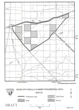
Bigelow Cholla >> Map #34
Bigelow Cholla Garden Wilderness
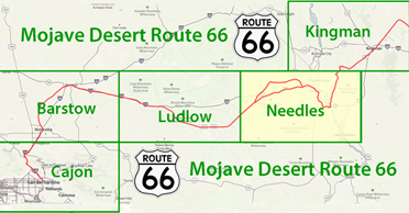
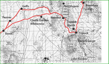
SIZE: 10,380 acresLOCATION: San Bernardino County; 17 miles west of Needles, California
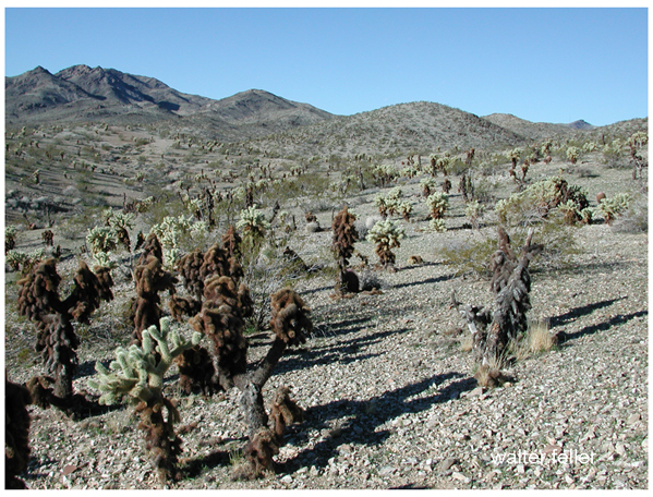
NATURAL RESOURCES: This wilderness area lies within the northern portion of the dark, volcanic Sacramento Mountains. The densest concentration of Bigelow cholla cactus in the California Desert is found within this wilderness.
| GLOSSARY | > volcanic |
 ACCESS: Interstate 40
forms the northern boundary of the wilderness. Exit U.S. Highway 95 from
1-40
and follow the dirt road south for about 200 feet. Turn right 180 degrees
to access the Four Corners's Pipeline and travel west. The southern
boundary, delineated by this road, begins in 3 miles. There are no
established trailheads, and high clearance vehicles are recommended.
ACCESS: Interstate 40
forms the northern boundary of the wilderness. Exit U.S. Highway 95 from
1-40
and follow the dirt road south for about 200 feet. Turn right 180 degrees
to access the Four Corners's Pipeline and travel west. The southern
boundary, delineated by this road, begins in 3 miles. There are no
established trailheads, and high clearance vehicles are recommended.
Geomorphic Province : Mojave Desert
Ecosection : Mojave Desert
Ecosubsection : Piute Valley - Sacramento Mountains
Mining History : Southeastern San Bernardino County
Native Culture : Mohave, Chemehuevi