Digital-Desert : Mojave Desert Photography by
Walter Feller

Visit us on Facebook
features - ecology: wildlife - plants - geography: places - region map - map/sat - roads & trails: route 66 - old west - communities - miscellaneous
ghost towns - gold mines - parks & ...: joshua tree - death valley - mojave preserve - wilderness - native culture - history - geology: natural features - glossary - comments

Wilderness - MAP
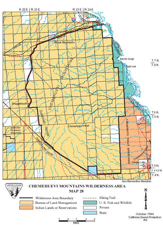
Chemehuevi Mountains >> Map #28

Chemehuevi Mountains Wilderness

SIZE: 64,320 acres

LOCATION: San Bernardino County; 12 miles southeast of Needles, California

ACCESS: Ten miles south of Needles, California, U.S. Highway 95 is intersected by a dirt pipeline road, which forms the northern boundary of the wilderness. It can also be reached from the east from the Colorado River through the Havasu Wilderness Area, which is within the Havasu Wildlife Refuge. Please note there is no overnight camping in the Refuge.

features - ecology: wildlife - plants - geography: places - region map - map/sat - roads & trails: route 66 - old west - communities - miscellaneous
ghost towns - gold mines - parks & ...: joshua tree - death valley - mojave preserve - wilderness - native culture - history - geology: natural features - glossary - comments
Country Life Realty
Mountain Homes and Real Estate for Sale

~ Wickless Candles by Scentsy ~
The Most Wonderful Time of the Year ...
... Is here
MH Sleds
Saucer sleds for the snow
Life time guarantee!!!

Abraxas Engineering
privacy
Copyright ©Walter Feller. All rights reserved.