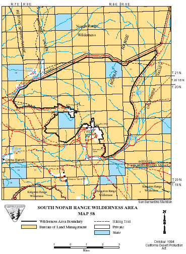
South Nopah Range >> Map #58
South Nopah Range Wilderness
SIZE: 16,780 acres
LOCATION: Inyo County; 3 miles east of Tecopa, California
NATURAL RESOURCES: The Nopah Range is rugged and shaded with color, its sedimentary rocks capping at 4,200 feet. Gently rolling alluvial fans and bajadas on the eastĀand west sweep up to the south end of the rugged folds of the Nopah Mountain Range. Desert bighorn sheep make their home in the northern portion of the mountain range year-round. The eastern part of this wilderness includes portions of California Valley. Vegetation is sparse, but prairie falcons have been seen hunting over most of the lowland areas. The environment here is known to support habitat for the ivory-spined agave plant, although no specimens have actually been collected from within the wilderness. Wild horses and burros also may be seen in the area.
| GLOSSARY | > alluvial fan, bajada |
ACCESS: Access this wilderness from State Highway 127 via the Spanish Trail Highway.