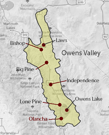
Owens Valley - Inyo Co.
Independence, California
Click the photo for more information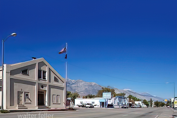
Independence, California - 2009
Independence, California, is a small town in Inyo County, California. It is situated in the Owens Valley, near the eastern slope of the Sierra Nevada mountains. The town has a population of approximately 600 people and covers 3 square miles.
Independence is known for its rich history and beautiful natural surroundings. It was founded in 1861 as a mining town during the California Gold Rush. The town's name was chosen to commemorate the Declaration of Independence.
One of Independence's main attractions is the Eastern California Museum. This museum showcases the Eastern Sierra region's history and culture. It houses various exhibits, including Native American artifacts, pioneer memorabilia, and mining equipment.
Another popular destination in Independence is the Manzanar National Historic Site. This site preserves and interprets the history of the Manzanar War Relocation Center. This is one of ten camps where Japanese-American citizens and resident Japanese aliens were interned during World War II. Visitors can explore the site and learn about those who were interned there.
Nature lovers will enjoy the scenic beauty of Independence and its surroundings. The town is near several national parks, including the Kings Canyon National Park and the Sequoia National Park. These parks offer a range of outdoor activities, such as hiking, camping, and wildlife viewing.
In terms of climate, Independence experiences hot summers and cold winters. The town is known for its clear skies, making it a popular destination for stargazing and astrophotography.
Independence, California, offers an impressive blend of history, natural beauty, and outdoor recreation. Whether you are interested in exploring the town's rich past or immersing yourself in the stunning landscapes of the Eastern Sierra region, Independence has something to offer.
Geography History Ecosubsections